GIS & Mapping
Hardware and Software
GIS workstations are available in the GIS Hub in the Kathleen A. Zar Room in the MADD Center, located in the Crerar Library. The workstations have ArcGIS, QGIS, and GeoDa, as well as R. The workstations in the Center for Digital Scholarship at Regenstein Library also have ArcGIS and QGIS software.
Map Collection
The Map Collection is home to over 475,000 maps, making it one of the largest academic map collections in North America. The collection is particularly strong in historical maps of Chicago, world cities, and thematic maps. With the help of the Map Collection Assistant, maps can be scanned for free on the 42” scanner located within the Map Library.
Data & Reference Services
Students, faculty, and staff at the University of Chicago have access to many geospatial databases, including: the BTAA Geoportal, Social Explorer, ArcGIS Online, and the Map Collection's datasets. Learn more through this LibGuide.
Learning GIS
The Library offers workshops on spatial thinking, GIS software, finding GIS data, and cartography. LinkedIn Learning provides many tutorials for learning ArcGIS and QGIS.
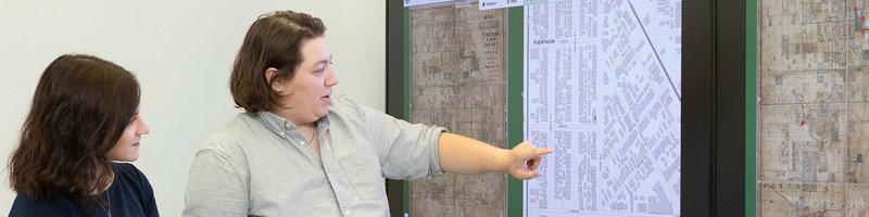
Research Consultations & Collaborations
Students, faculty, and staff can schedule research and teaching consultations with GIS experts by contacting the Center for Digital Scholarship. We can assist with locating appropriate data sources, getting started with GIS software, creating maps, incorporating geospatial resources in teaching, and provide guidance with spatial research questions.
For assistance with geocoding addresses, use the Research Computing Center’s free batch geocoder service.
Classroom & Online Instruction
The GIS Librarian is available for class visits to present GIS resources or to host small classes in the GIS Hub for live demos and workshops. Instructors may also request customized library guides for their courses.