| Image |
Title Information |
Subject Headings |
Description |
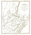 |
Afrique, au Nord-Est de la Colonie du Cap : dressée pour
montrer la position relative des fermiers émigrans et des
tribus natives / par le Capitaine W.C. Harris, du Corps des
Ingénieurs de Bombay, Mai 1837 ; dessiné et
gravé par Ambroise Tardieu. |
Ethnology--Africa, Southern--Maps. |
Scale 1:5,000,000. [Paris : Société de
géographie], 1838. 1 map : col. ; 23 x 20 cm. |
 |
Mappemonde en deux hémisphères : indication des
races d'hommes qui ont peuplé le globe / dressée par
Fx. Ansart pour l'usage des collèges ; dessiné par
Fremin ; gravé par Artus ; écrit par Hacq. |
Ethnology--Maps.
World maps. |
Scale not given. [Paris? : s.n.], 1838. 1 map : col. ; 2
hemispheres, each 24 cm. in diam., on sheet 35 x 54 cm. |
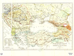 |
Map to illustrate Professor Max Müller's "Suggestions" for
the assistance of officers in learning the languages of the seat of
war in the East / drawn by Augustus Petermann, 1854 ; lith. by A.
Petermann. |
Turkey--Languages--Maps.
Balkan Peninsula--Languages--Maps. |
Scale [ca. 1:6,000,000]. [London : Williams and Norgate, 1855].
1 map : col. ; 32 x 46 cm. |
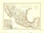 |
Essai d'une carte ethnographique du Mexique : d'après
les travaux de Clavigero, de Humboldt, de Beltrami, de Stephens, de
Duflot de Mofras, et de Brasseur de Bourbourg / par V.A. Malte-Brun
; gravé par Erhard. |
Ethnology--Mexico--Maps.
Indians of Mexico--Maps. |
Scale 1:7,000,000. [France : s.n.], 1864. 1 map : col. ; 32 x
45 cm. |
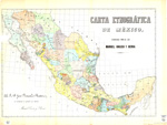 |
Carta etnográfica de México / formada por el Lic.
Manuel Orozco y Berra. |
Indians of Mexico--Maps. |
Scale [ca. 1:4,200,000]. México] : Lit de Salazar,
[1864?]. 1 map : col. ; 50 x 72 cm. |
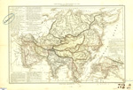 |
Carte politique et ethnographique de l'Asie / par MMrs. Drioux
et Ch. Leroy ; gravé par Jenotte. |
Ethnology--Asia--Maps.
Asia -- Maps. |
Scale [ca. 1:28,500,000]. Paris : Librairie classique
d'Eugène Belin, [1867?]. 1 map : col. ; 30 x 43 cm. |
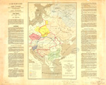 |
Carte linguistique, ethnographique, et politique actuelle de
l'Europe orientale, Russie, Autriche, Turquie / par Casimir
Delamarre ; gravé chez Erhard. |
Europe, Eastern--Languages--Maps. |
Scale [ca. 1:6,000,000] . [Paris] : Lanée,
éditeur : Dentu, éditeur, 1868. 1 map : col. ; 47 x
30 cm. |
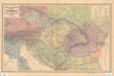 |
Völker- und Sprachen-Karte von Österreich und den
Unter-Donau-Ländern / zusammengestellt von H. Kiepert. |
Ethnology--Austria--Maps.
Ethnology--Hungary--Maps.
Ethnology--Balkan Peninsula--Maps. |
Scale 1:3,000,000. Berlin : D. Reimer, 1869. 1 map : col. ; 36
x 58 cm. |
 |
Völker[-] und Sprachen-Karte von Deutschland und den
Nachbarländern / zusammengestellt von H. Kiepert. |
Ethnology--Germany--Maps.
Ethnology--Poland--Maps.
Ethnology--Europe, Central--Maps. |
Scale 1:3,000,000. Berlin : D. Reimer, [1872]. 1 map : col. ;
42 x 54 cm. |
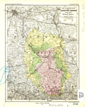 |
Das Sprachgebiet der Lausitzer Wenden, 1550-1872 / von Richard
Andree. |
Sorbs--Germany--Maps.
Sorbs--Germany--History--Maps. |
Scale 1:750,000. Gotha : Justus Perthes, 1873. 1 map : col. 24
x 19 cm. |
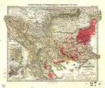 |
Die neueste Eintheilung, die türkischen Gebiete & die
Confessionen in der Türkei / von A. Petermann ; bearbeitet von
H. Habenicht. |
Balkan Peninsula--Balkan Peninsula--Maps.
Turks--Balkan peninsula--Maps. |
Scale 1:2,500,000. Gotha : Justus Perthes, 1876. 1 map : col. ;
33 x 45 cm. |
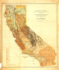 |
Map showing the distribution of the Indian tribes in California
: to illustrate report of Stephen Powers / Department of the
Interior, U.S. Geographical and Geological Survey of the Rocky
Mountain Region. |
Indians of North America--California--Maps.
Indians of North America--California--Languages--Maps. |
Scale [ca. 1:1,810,000]. [Washington, D.C.] : Geographical and
Geological Survey of the Rocky Mountain Region, 1877. 1 map : col.
; 64 x 56 cm. |
 |
Deutsche & Romanen in Süd-Tirol & Venetien / nach
Chr. Schneller ; von A. Petermann. |
Ethnology--Italy--Bolzano (Province)--Maps.
Ethnology--Italy--Friuli-Venezia Giulia--Maps. |
Scale 1:740,000. Gotha : Justus Perthes, 1877. 1 map : col. ;
27 x 44 cm. |
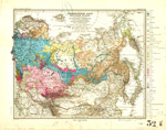 |
Ethnographische Karte des Russischen Reiches, nebst Andeutung
der hauptsächlichen Völkergrenzen in den Nachbargebieten
: hauptsächlich nach Rittich und Venjukoff / von A. Petermann
; bearbeitet v. Hanemann. |
Ethnology--Russia--Maps. |
Scale 1:20,000,000. Gotha : Justus Perthes, 1877. 1 map : col.
; 33 x 42 cm. |
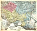 |
Vertheilung der Gross-, Weiss- & Klein-Russen, nach A.F.
Rittich / von A. Petermann. |
Ethnology--Russia, Western--Maps.
Slavs--Russia, Western--Maps. |
Scale 1:3,700,000. Gotha : Justus Perthes, 1878. 1 map : col. ;
44 x 53 cm. |
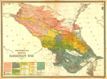 |
Этнографическая
карта
Кавказскаго
края [Ėtnograficheskai͡a karta
Kavkazskago krai͡a] /
составленная
по
новѣйшим
свѣдѣніям
А. Риттихом
[sostavlennai͡a po novi͡eĭshim
svi͡edi͡enīi͡am A. Rittikhom]. |
Ethnology--Caucasus, South--Maps. |
Scale 1:1,080,000. С[анкт]
Петербург
[S[ankt] Peterburg] :
КартограФическое
зав. А.
Ильина [Kartograficheskoe zav.
A. Il'ina], [1878?]. 1 map : col. ; 73 x 99 cm. |
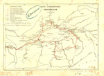 |
Carte ethnographique du Ferghanah / par C.E. de Ujfalvy, 1877 ;
dessinée par J. Hansen, d'après la carte de A.
Fedchenko et le manuscrit de l'auteur. |
Ethnology--Fergana Valley--Maps.
Ujfalvy, Ch.-E. de--Travel--Maps. |
Scale 1:1,250,000. [Paris : Société de
géographie], 1878. 1 map : col. ; 19 x 27 cm. |
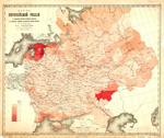 |
Карта
европейской
Россіи, съ
показаніемъ
процента
учившихся
дѣвочекъ
въ
сельскихъ
училищахъ
къ
населенію
учебнаго
возраста
(отъ 7 до 14 лѣт
включ.) по
уѣздамъ, по
свѣдѣніямъ
за 20ое.
марта 1880
года [Karta evropeiskoĭ Rossīi, s
pokazanīem prot͡senta uchivshikhsi͡a di͡evochek
v sel'skikh uchilishchakh k naselenīi͡u uchebnago
vozrasta (ot 7 do 14 li͡et vkli͡uch.) po ui͡ezdam,
po svi͡edi͡enii͡am za 20oe. marta 1880 goda] /
составили
м.
редакторъ
Центральнаго
статистическаго
комитета
А.В.
Дубровскій
и
картографъ
комитета
А.Н.
Петровскій
[sostavili M. redaktor T͡Sentral'nago statisticheskago
komiteta A.V. Dubrovskīĭ i kartograf komiteta A.N.
Petrovskīĭ]. |
School children--Russia, Western--Maps.
Education--Russia, Western--Maps. |
Scale [1:16,800,000]. В
С[анктъ]
петербургѣ
[V S[ankt] Peterburgi͡e] :
КартограФическое
заведеніе
А. Ильина,
[Kartograficheskoe zavedenīe A. Il'ina], [1880?]. 1 map : col.
; 60 x 71 cm. |
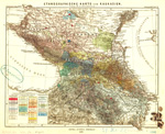 |
Ethnographische Karte von Kaukasien / von N. v. Seidlitz ; auf
Petermanns Karte v. Ost-Europa gez. v. W.H. Fritzsche. |
Ethnology--Caucasus--Maps. |
Scale [ca. 1:3,500,000]. Gotha : Justus Perthes, 1880. 1 map :
col. ; 27 x 31 cm. |
 |
ЭтнограФическая
карта
Азіятской
Россіи,
Туркестана,
и
киргизских
степей
[Ėtnograficheskai͡a karta Azīi͡atskoĭ
Rossīi, Turkestana, i kirgizskikh stepeĭ]. |
Ethnology--Asiatic Russia--Maps. |
Scale 1:16,500,000. [Saint Petersburg] :
КартограФическое
заведеніе
А. Ильина
[Kartograficheskoe zavedenīe A. Il'ina], [188-?]. 1 map : col.
; 27 x 44 cm. |
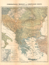 |
Ethnographische Übersicht des europäischen Orients /
zusammengestellt von H. Kiepert. |
Ethnology--Balkan Peninsula--Maps. |
Scale [ca. 1:3,000,000]. Berlin : Verlag von D. Reimer,
[1882?]. 1 map : col. ; 52 x 44 cm. |
 |
Plan von Constantinopel mit den Vorstädten, dem Hafen, und
einem Theile des Bosporus / aufgenommen und gezeichnet von C.
Stolpe nach den zeitherigen Veränderungen berichtigt bis zum
Jahre 1882 = Plan de Constantinople avec ses faubourgs, le port et
une partie du Bosphore / levé et dessiné par C.
Stolpe, verifié d'après les changements les plus
récents jusqu'en 1882 |
Istanbul (Turkey)--Maps.
Ethnology--Turkey--Istanbul--Maps. |
Scale 1:15,000. Constantinopel : Verlag von Lorentz & Keil,
1882. 1 map : col. ; 69 x 52 cm. |
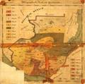 |
Ethnographische Karte von Guatemala / [Otto Stoll]. |
Ethnology--Guatemala--Maps. |
Scale 1:1,500,000. Zürich : Lith. Orell Füssli &
Co., [1884]. 1 map : col. ; 34 x 37 cm. |
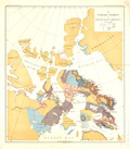 |
The Eskimo tribes of north-east America / by F. Boas. |
Eskimos--Canada, Northern--Maps.
Eskimos--Population--Maps. |
Scale not given. [Washington? : Government Printing Office?,
1885?]. 1 map : col. ; 52 x 47 cm. |
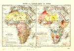 |
Kultur- und Staaten-Karte von Afrika / von Fr. Ratzel. |
Ethnology--Africa--Maps.
Africa--Administrative and political divisions--Maps. |
Scale 1:54,000,000. Gotha : Justua Perthes, 1885. 2 maps on 1
sheet : col. ; sheet 27 x 40 cm. |
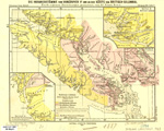 |
Die Indianerstämme von Vancouver Id. und an der Küste
von Britisch-Columbia / nach eigenen Forschungen gezeichnet von
Franz Boas ; red. v. B. Hassenstein ; aut. v. C. Schmidt. |
Indians of North America--British Columbia--Maps. |
Scale 1:2,000,000. Gotha : Justus Perthes, 1887. 1 map : col. ;
19 x 25 cm., on sheet 22 x 28 cm. |
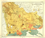 |
Ethnographische Karte von Makedonien und Alt-Serbien / von
Spiridion Gopcevic. |
Ethnology--Macedonia (Republic)--Maps.
Ethnology--Greece--Macedonia--Maps. |
Scale 1:850,000. Gotha : Justus Perthes, 1889. 1 map : col. ;
41 x 49 cm. |
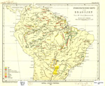 |
Ethnographische Karte von Brasilien / von Paul Ehrenreich ;
red. v. B. Hassenstein ; aut. v. C. Schmidt. |
Ethnology--Brazil--Maps. |
Scale 1:20,000,000. Gotha : Justus Perthes, 1891. 1 map :col. ;
25 x 31 cm. |
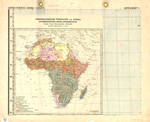 |
Ethnographische Übersicht von Afrika mit
Berücksichtigung v. Kultur- u. Eingebornen-Staaten : nach
Cust-Ravenstein u. Ratzel / entworfen v. H. Habenicht ; gez. v. C.
Barich. 3 Aufl. |
Ethnology--Africa--Maps. |
Scale 1:25,000,000. Gotha : [Justus Perthes], 1892. 1 map :
col., ; 39 x 40 cm. |
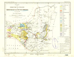 |
Karte der Verbreitung der Sprachen in Südost-Mexico und
British Honduras um's Jahr 1894 / von Karl Sapper. |
Mexico--Languages--Maps.
Belize--Languages--Maps. |
Scale 1:4,000,000. Gotha : Justus Perthes, 1895. 1 map : col. ;
29 x 38 cm. |
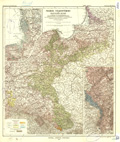 |
Fremde Volksstämme im deutschen Reiche verglichen mit der
Verteilung der christlichen Hauptbekenntnisse : auf Grund der
neuesten amtlichen u. ausseramtlichen Aufnahmen gemeindeweise /
bearbeitet von Paul Langhans ; auf Vogels Karte des deutschen
Reichs in Stielers Hand-Atlas. |
Ethnology--Germany--Maps.
Ethnology--Poland--Maps. |
Scale 1:1,500,000. Gotha : Justus Perthes, 1895. 1 map : col. ;
48 x 42 cm. |
 |
Nationalities map no. 1[-4], Polk St. to Twelfth ...
Chicago. |
Ethnology--Illinois--Chicago--Maps.
Near West Side (Chicago, Ill.)--Maps. |
Scale [ca. 1:1,865]. New York : Thomas Y. Crowell & Co.,
1895. 4 maps on 1 sheet : col. ; sheet 36 x 112 cm. |
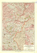 |
Die Thätigkeit der Ansiedelungs-Kommission für die
Provinzen Westpreussen und Posen, 1886-1896 / auf Grund amtlicher
Angaben entworfen von Paul Langhans ; auf Vogels Karte des
Deutschen Reiches in 1:500.000. |
Ethnology--Poland--Prussia, West--Maps. |
Scale 1:500,000. Gotha : Justus Perthes, 1896. 1 map : col. ;
60 x 41 cm. |
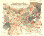 |
Verteilung der armenischen Bevölkerung in
Türkisch-Armenien, Kurdistan, u. Transkaukasien : nach Cuinet,
Selenoy, und v. Seydlitz / entworfen von A. Supan ; B.H. del. |
Armenians--Turkey--Maps.
Armenians--Caucasus--Maps.
Ethnology--Turkey--Maps.
Ethnology--Caucasus--Maps. |
Scale 1:3,700,000. Gotha : Justus Perthes, 1896. 1 map : col. ;
21 x 25 cm. |
 |
Das khartwelische Sprachgebiet im südwestlichen Kaukasus /
von Hugo Schuchardt ; red. v. B. Hassenstein. |
Kartvelian languages--Maps.
Ethnology--Caucasus--Maps.
Caucasus--Languages--Maps. |
Scale 1:1,300,000. Gotha : Justus Perthes, 1897. 1 map : col. ;
26 x 42 cm. |
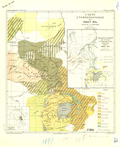 |
Carte ethnographique du Haut Nil / dressée par E. de
Martonne ; gravé par A. Simon. |
Ethnology--Africa--Maps. |
Scale 1:6,000,000. [Paris] : Armand Colin & Cie.,
éditeurs, 1897. 1 map : col. ; 36 x 32 cm. |


|
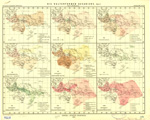
Der westafrikanische Kulturkreis / von L. Frobenius ; red. v.
B. Hassenstein ; aut. v. C. Schmidt. |
Human geography--Africa--Maps.
Ethnology--Africa--Maps. |
Scale [ca. 1:50,000,000]. Gotha : Justus Perthes, 1897-1898. 20
maps on 2 sheets : col. ; maps 11 x 13 cm. each, sheets 28 x 69
cm. |
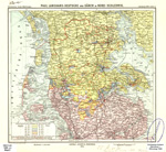 |
Deutsche und Dänen in Nord-Schleswig / Paul Langhans. |
Ethnology--Germany--Schleswig-Holstein--Maps.
Ethnology--Denmark--Syddanmark--Maps. |
Scale [ca. 1:500,000]. Gotha : Justus Perthes, 1899. 1 map :
col. ; 25 x 33 cm. |
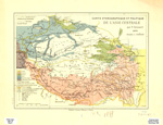 |
Carte ethnographique et politique de l'Asie centrale / par F.
Grenard, 1899 ; J. Hansen. |
Ethnology--China--Xinjiang Uygur Zizhiqu--Maps.
Ethnology--China--Tibet--Maps.
Ethnology--China--Qinghai Sheng--Maps.
Ethnology--Asia, Central--Maps. |
Scale 1:9,000,000. Paris : Ernest Leroux, [1899?]. 1 map : col.
; 23 x 33 cm. |
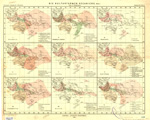  |
Die Kulturformen Ozeanien's / von L. Frobenius ; red. v. B.
Hassenstein. |
Ethnology--Oceania--Maps. |
Scale [ca. 1:10,000,000]. At equator. Gotha : Justus Perthes,
1900. 18 maps on 2 sheets : col. ; maps 13 x 17 cm. each, sheets 43
x 53 cm. |


